- 5 replies
- 4,961 views
- Add Reply
- 2 replies
- 2,449 views
- Add Reply
- 0 replies
- 5,739 views
- Add Reply
- 0 replies
- 1,548 views
- Add Reply
- 2 replies
- 2,193 views
- Add Reply
New Release ENVI 6.0

By Lurker,
Added support for data types:
GRUS L1C, L2A - Axelspace micro-earth observation satellite
ISIS3 - USGS Astrogeology ISIS Cube, Version 3
PDS4 -NASA Planetary Data System, Version 4
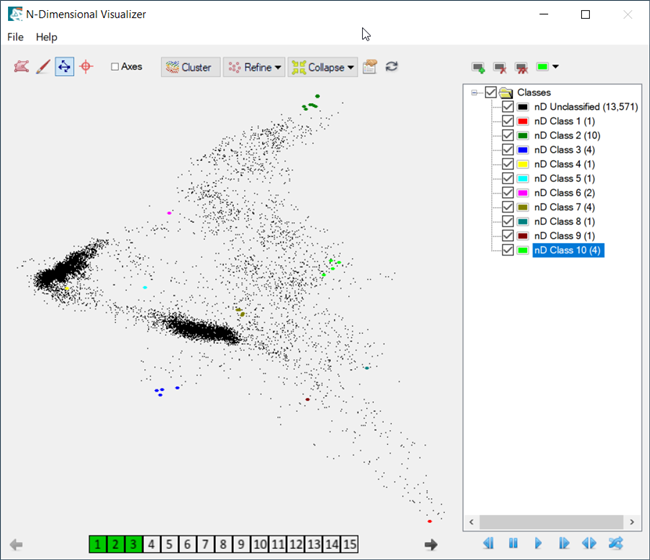
New Spectral Hourglass Workflow and N-Dimensional Visualizer
New Target Detection Workflow
The Target Detection Workflow has been added to this release. Use the Target Detection Workflow to locate objects within hyperspectral or multispectral images that match the signatures of
TerraExplorer 8.0 Installer Download Link

By lreept,
TerraExplorer 8.0 Installer Download Link🙂:https://pan.baidu.com/s/1Y33PRnVk5SwqLEenVaaG6g?pwd=qq7m
Calibrating Multispectral Without Reflectance Panel

By hbrillon,
Is there a way to calibrate multispectral imagery without using a reflectance panel? I have two sets of data that need to be calibrated but they were flown without using a reflectance panel. The sensor is a Micasense RedEgde-MX. Both sets are taken in the same area.
Post-Doctoral Research Fellowship in Advanced Earth Observation (EO) for Earth Science
By Lurker,
Are you a post-doctoral researcher looking for an exciting opportunity in advanced Earth Observation (EO) for Earth Science? The ESA is offering a two-year research fellowship in the Directorate of Earth Observation Programmes. The fellowship will cover a wide range of innovative topics from the development and validation of novel methods, algorithms and EO products to innovative Earth system and climate research. The successful candidate will be responsible for undertaking advanced research add
How can i train a deep learning model to extract the building footprint

By Yasser,
I’am a Geomatics student and i want to train a deep learning model to extract the building footprint of a city, how can i do it ? It is easy to do for Geomatics or survey engineer ? Or this project need to IT background ?
thanks
-
Forum Statistics
8.7k
Total Topics43.3k
Total Posts
-
Latest Posts
-

By intertronic · Posted
try this https://www.arcgis.com/home/item.html?id=a6857359a1cd44839781a4f113cd5934 you need arcgis pro and the extension "image analyst" -
When two Finnair planes flying into Estonia recently had to divert in quick succession and return to Helsinki, the cause wasn’t a mechanical failure or inclement weather—it was GPS denial. GPS denial is the deliberate interference of the navigation signals used and relied on by commercial aircraft. It’s not a new phenomenon: The International Air Transport Association (IATA) has long provided maps of regions where GPS was routinely unavailable or untrusted. However, concern is growing rapidly as conflict spreads across Europe, the Middle East, and Asia, and GPS jamming and spoofing become weapons of economic and strategic influence. Several adversarial nations have been known to use false (spoofed) GPS signals to interfere with air transit, shipping, and trade, or to disrupt military logistics in conflict zones. And recent discussions of anti-satellite weapons renewed fears of deliberate actions designed to wreak economic havoc by knocking out GPS. GPS has become so ubiquitous in our daily lives that we hardly think about what happens when it’s not available A GPS outage would result in many online services becoming unavailable (these rely on GPS-based network synchronization), failure of in-vehicle Satnav, and no location-based services on your mobile phone. Analyses in the U.S. and U.K. have both identified the temporary economic cost of an outage at approximately $1 billion per day—but the strategic impacts can be even more significant, especially in a conflict. The saying is that infantry wins battles, but logistics wins wars. It’s almost unimaginable to operate military logistics supply chains without GPS given the heavy reliance on synchronized communications networks, general command and control, and vehicle and materiel positioning and tracking. All of these centrally rely on GPS and all are vulnerable to disruption. Most large military and commercial ships and aircraft carry special GPS backups for navigation because there was, in fact, a time before GPS GPS is not available in all settings—underground, underwater, or at high latitudes. The GPS alternatives rely on signals that can be measured locally (for instance, motion or magnetic fields as used in a compass), so a vessel can navigate even when GPS is unavailable or untrusted. For example, inertial navigation uses special accelerometers that measure vehicle motion, much like the ones that help your mobile phone reorient when you rotate it. Measuring how the vehicle is moving and using Newton’s laws allows you to calculate your likely position after some time. Other “alt-PNT” approaches leverage measurements of magnetic and gravitational fields to help navigate against a known map of these variations near the Earth’s surface. Plus, ultrastable locally deployed clocks can ensure communications networks remain synchronized during GPS outages (comms networks typically rely on GPS timing signals to remain synchronized). Nonetheless, we rely on GPS because it’s simply much better than the backups. Focusing specifically on positioning and navigation, achieving good performance with conventional alternatives typically requires you to significantly increase system complexity, size, and cost, limiting deployment options on smaller vehicles. Those alternative approaches to navigation are also unfortunately prone to errors due to the instability of the measurement equipment in use—signals just gradually change over time, with varying environmental conditions, or with system age. We keep today’s alternatives in use to provide a backstop for critical military and commercial applications, but the search is on for something significantly better than what’s currently available. That something looks to be quantum-assured navigation, powered by quantum sensors. Quantum sensors rely on the laws of nature to access signatures that were previously out of reach, delivering both extreme sensitivity and stability As a result, quantum-assured navigation can deliver defense against GPS outages and enable transformational new missions. The most advanced quantum-assured navigation systems combine multiple sensors, each picking up unique environmental signals relevant to navigation, much the way autonomous vehicles combine lidar, cameras, ultrasonic detectors, and more to deliver the best performance. This starts with a new generation of improved quantum inertial navigation, but quantum sensing allows us to go further by accessing new signals that were previously largely inaccessible in real-world settings. While it may be surprising, Earth’s gravity and magnetic fields are not constant everywhere on the planet’s surface. We have maps of tiny variations in these quantities that have long been used for minerals prospecting and even underground water monitoring. We can now repurpose these maps for navigation. We’re building a new generation of quantum gravimeters, magnetometers, and accelerometers—powered by the quantum properties of atoms to be sensitive and compact enough to measure these signals on real vehicles. The biggest improvements come from enhanced stability. Atoms and subatomic particles don’t change, age, or degrade—their behavior is always the same. That’s something we are now primed to exploit. Using a quantum-assured navigation system, a vehicle may be able to position itself precisely even when GPS is not available for very long periods. Not simply hours or days as is achievable with the best military systems today, but weeks or months. In quantum sensing, we have already achieved quantum advantage—when a quantum solution decidedly beats its conventional counterparts. The task at hand is now to take these systems out of the lab and into the field in order to deliver true strategic advantage. That’s no mean feat. Real platforms are subject to interference, harsh conditions, and vibrations that conspire to erase the benefits we know quantum sensors can provide. In recent cutting-edge research, new AI-powered software can be used to deliver the robustness needed to put quantum sensors onto real moving platforms. The right software can keep the systems functional even when they’re being shaken and subjected to interference on ships and aircraft. To prevent a repeat of the Finnair event, real quantum navigation systems are now starting to undergo field testing. Our peers at Vector Atomic recently ran maritime trials of a new quantum optical clock. The University of Birmingham published measurements with a portable gravity gradiometer in the field. At Q-CTRL, we recently announced the world’s first maritime trial of a mobile quantum dual gravimeter for gravity map matching at a conference in London. My team is excited to now work with Airbus, which is investigating software-ruggedized quantum sensors to provide the next generation of GPS backup on commercial aircraft. Our full quantum navigation solutions are about to commence flight safety testing with the first flights later in the year, following multiple maritime and terrestrial trials. With a new generation of quantum sensors in the field, we’ll be able to ensure the economy keeps functioning even in the event of a GPS outage. From autonomous vehicles to major shipping companies and commercial aviation, quantum-assured navigation is the essential ingredient in providing resilience for our entire technology-driven economy.
-
A Falcon 9 successfully launched an Earth science mission for Europe and Japan May 28 as part of the European Space Agency’s ongoing, if temporary, reliance on SpaceX for space access. The Falcon 9 lifted off from Vandenberg Space Force Base in California at 6:20 p.m. Eastern. The payload, the Earth Cloud Aerosol and Radiation Explorer (EarthCARE) spacecraft, separated from the upper stage about 10 minutes after liftoff. Simonetta Cheli, director of Earth observation programs at ESA, said in a post-launch interview that controllers were in contact with the spacecraft. “It is all nominal and on track.” Spacecraft controllers will spend the weeks and months ahead checking out the spacecraft’s instruments and calibrating them, she said. That will allow the first release of science data from EarthCARE around the end of this year or early next year. EarthCARE is an 800-million-euro ($870 million) ESA-led mission to study clouds and aerosols in the atmosphere. The spacecraft carries four instruments, including a cloud profiling radar provided by the Japanese space agency JAXA at a cost of 8.3 billion yen ($53 million). JAXA dubbed the spacecraft Hakuryu or “White Dragon” because of the spacecraft’s appearance. The 2,200-kilogram spacecraft, flying in a sun-synchronous orbit at an altitude of 393 kilometers, will collect data on clouds and aerosols in the atmosphere, along with imagery and measurements of reflected sunlight and radiated heat. That information will be used for atmospheric science, including climate and weather models. “EarthCARE is there to study the effect of clouds and aerosols on the thermal balance of the Earth,” said Dirk Bernaerts, ESA’s EarthCARE project manager, at a pre-launch briefing May 21. “It’s very important to observe them all together at the same location at the same time. That is what is unique about this spacecraft.” Other spacecraft make similar measurements, including NASA’s Plankton, Aerosol, Cloud, ocean Ecosystem (PACE) spacecraft launched in February. “The observation techniques are different,” he said. “We observe the same thing but observe slightly different aspects of the clouds and aerosols.” He added that EarthCARE would use PACE data to help with calibration and validation of its observations. Development of EarthCARE took about two decades and resulted in cost growth that Cheli estimated at the pre-launch briefing to be 30%. Maximilian Sauer, EarthCARE project manager at prime contractor Airbus, said several factors contributed to the delays and overruns, including technical issues with the instruments as well as effects of the pandemic. One lesson learned from EarthCARE, Cheli said in the post-launch interview, was the need for “strict management” of the project, which she said suffered from challenges of coordinating work between agencies and companies. The mission also underscored the importance of strong support from member states as it worked to overcome problems, she added. Another factor in EarthCARE’s delay was a change in launch vehicles. EarthCARE was originally slated to go on a Soyuz rocket but ESA lost access to the vehicle after Russia’s invasion of Ukraine. The mission was first moved to Europe’s Vega C, but ESA decided last June to launch it instead on a Falcon 9, citing delaying in returning that rocket to flight as well as modifications to the rocket’s payload fairing that would have been needed to accommodate EarthCARE. Technically, the shift in launch vehicles was not a major problem for the mission. “Throughout the changes in the launchers we did not have to change the design of the spacecraft,” said Bernaerts. He said that, during environmental tests, engineers put the spacecraft through conditions simulating different launch vehicles to prepare for the potential of changing vehicles. “From the moment we knew that Soyuz was not available, we have been looking at how stringently we could test the spacecraft to envelope other candidate launchers. That’s what we did and that worked out in the end.” EarthCARE is the second ESA-led mission to launch on a Falcon 9, after the Euclid space telescope last July. Another Falcon 9 will launch ESA’s Hera asteroid mission this fall. “We had a good experience with Euclid last year,” said Josef Aschbacher, ESA director general, in a post-launch interview. “Our teams and the SpaceX teams are working together very well.” The use of the Falcon 9 is a stopgap until Ariane 6 enters services, with a first launch now scheduled for the first half of July, and Vega C returns to flight at the end of the year. “I hear lots of questions about why we’re launching with Falcon and not with Ariane, and it’s really good to see the Ariane 6 inaugural flight coming closer,” he said. Those involved with the mission were simply happy to finally get the spacecraft into orbit. “There is a feeling of relief and happiness,” Cheli said after the launch. “This is an emotional roller coaster,” said Thorsten Fehr, EarthCARE mission scientist at ESA, on the agency webcast of the launch shortly after payload separation. “This is one of the greatest moments in my professional life ever.”
-
Maker Ilia Ovsiannikov is working on a friendly do-it-yourself robot kit — and as part of that work has released a library to make it easier to use a range of lidar sensors in your Arduino sketches. "I have combined support for various spinning lidar/LDS sensors into an Arduino LDS library with a single platform API [Application Programming Interface]," Ovsiannikov explains. "You can install this library from the Arduino Library Manager GUI. Why support many lidar/LDS sensors? The reason is to make the hardware — supported by [the] Kaia.ai platform — affordable to as many prospective users as possible. Some of the sensors [suported] are sold as used robot vacuum cleaner spare parts and cost as low as $16 or so (including shipping)." The library delivers support for a broad range of lidar sensors from a unified API, Ovsiannikov explains, meaning it's not only possible to get started quickly but to switch sensors mid-project — should existing sensors become unavailable, or pricing shift to favor a different model. It also adds a few neat features of its own, including pulse-width modulation (PWM) control of lidar motors that lack their own control system, using optional adapter boards. While the library is usable standalone, and even to perform real-time angle and distance computation directly on an Arduino microcontroller, Ovsiannikov has also published a companion package to tie it in to the Robot Operating System 2 (ROS2). "[The] Kaia.ai robot firmware forwards LDS raw data — obtained from the Arduino LDS library — to a PC running ROS2 and micro-ROS," he explains. "The ROS2 PC kaiaai_telemetry package receives the raw LDS data, decodes that data and publishes it to the ROS2 /scan topic." More information on the library is available in Ovsiannikov's blog post, while the library itself is available on GitHub under the permissive Apache 2.0 license. more information: https://kaia.ai/blog/arduino-lidar-library/ https://github.com/kaiaai/LDS
-
-
Latest Topics
-
-
Recent Achievements
-


