- 0 replies
- 1,673 views
- Add Reply
- 4 replies
- 4,961 views
- Add Reply
- 0 replies
- 2,478 views
- Add Reply
- 1 reply
- 1,460 views
- Add Reply
- 8 replies
- 3,557 views
- Add Reply
ArcGIS Python API (Beta) Announced

By Lurker,


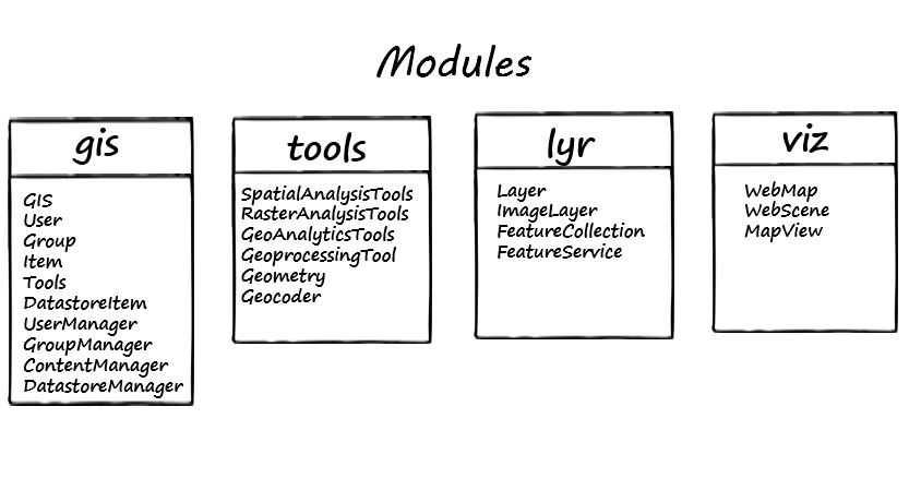
The API lets users perform GIS visualization and analysis, spatial data/content management as well as organization administration, using both an interactive console, as well as scripts in a batch processing environment.
The API integrates well with the Jupyter Notebook and the SciPy stack, enabling academics, data scientists and GIS analysts to share programs and reproducible research with others.
The API has a modular design that makes it simple to use and understand. These modules c
TopoMapCreator (beta)

By darksabersan,

TopoMapCreator (beta) A set of GIS tools that helps creating topographic map
TopoMapCreatorThe TopoMapCreator consists of of 5 Programs: MapCreator, GeoToolsCmd, TopoMap, EcwToMobile and ExtendedMapCreator. More information for example about how to install it, you find under TopoMapCreator.
Now read, what the 5 Programs are doing:
1. ExtendedMapCreatorExtendedMapCreator is a Desktop-Program, that creates "Topographic Maps" from OSM, NASA and ESA. You simply define a map extent by draggi
Bing Maps V8 Web Control Released and Deprecation Plan

By Lurker,


Two and a half months ago, at the Microsoft //Build/ Conference, the Bing Maps team announced the preview release of the Bing Maps V8 web control. Since then, the team has been working hard fixing bugs, adding new features and support for mobile, and making the Bing Maps V8 control stable and ready for production. Today we are happy to announce that Bing Maps V8 control has graduated from preview and is ready for use in production applications. The Bing Maps V8 control reduces development time
ESRI CityEngine 2016
By mandarbgis,
Hi all.
Welcome, Build Smart 3D Cities in CityEngine 2016 !!!
http://www.esri.com/esri-news/releases/16-2qtr/build-smart-3d-cities-in-minutes-with-gamechanging-esri-cityengine-2016
Remote Sensing and GIS Tutorial
By ajaysbharadwaj,
Hi All, I am a Doctorate in Remote Sensing and GIS. I have created an online tutorial Geospatial Technologies primarily concentrating on practical aspects both for beginners and for advanced learners. I am sure this will be useful for the members. Please have a look at the following link. https://www.youtube.com/channel/UCK-8Ky7ZiohkOrHpe6EM1Lw Tutorials are totally free of cost and created just out of passion to help students and professionals in the field of Geospatial Technologies.
-
Forum Statistics
8.8k
Total Topics43.5k
Total Posts


