- 1 reply
- 1,145 views
- Add Reply
- 2 replies
- 3,154 views
- Add Reply
- 4 replies
- 1,995 views
- Add Reply
- 1 reply
- 1,905 views
- Add Reply
- 0 replies
- 1,667 views
- Add Reply
How to use set deflection(right click while drawing lines) through arcpy?
By kron,
The set deflection option can be used to create a segment at a +-angle from a an existing line segment. This is exactly what i need but with the ability to run it several times in a loop.
In this case the vertex of the starting point is selected and the reference line segment is selected and 'set deflection' option is used to constrain the line to be drawn in a particular direction.
bearing distance to line is very static. you have to specify every parameter. can somebody guide me to use it
Reduce html popup image size in Dataeast Carrymap for ArcGIS
By nnico,
Hello to all. Have a problem with creting html popup with Carrymap in ArcGIS. Images appears too big for popup. Script for image insert:
<% var tag = '<img src="';
tag += CF.Values["img"] + ".JPG";
tag += '">';
echo (tag);
%>
Could I change image size in pixels or percents in script?
How to have a DEM for plant height
By laura_p,
Hello everyone,
I'm here to post a very basic question about DEMs.
Can a DEM be derived only with Lidar\Radar technologies? Or are there ways to elaborate a DEM also from optical?
I am working on crop classification and it would be extremely useful for me to be able to derive plant height from the optical data I'm working with (both Landsat8 and Sentinel2).
Thank you for your attention,
Laura
SQL Server: How to create Wedge (ST_Geometry)
By arso,


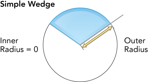
I want to create a Wedge in SQL server without using any mapping tool like ArcMap, which will be visualized (only) in ArcGIS. Unfortunately, ST_Geometry is not supported in SQL Server and CircularString is not supported in ArcGIS.
I assumed to create a buffer around a point but my actual requirement is just a wedge (partial circle with start and end angles).
For Example, for parametric wedges in PostgreSQL/PostGIS
sde.st_geometry (x, y, z, m, startangle, endangle, outerradius, innerradiu
UAS Survey of a Mountain Highway in Macedonia
By ptapken,
View this survey video with the Trimble UX5 HP and many other videos and case studies on Geo-matching.
-
Forum Statistics
8.8k
Total Topics43.5k
Total Posts


